
French Alps
South
East
Corsica
Centre
Australia
NSW
Thornleigh to Mt KuringGai
Spit bridge to Manly
Malabar circuit
Kurnel
Snowy mountains
New Zealand
USA
Latin
Reunion Island


")


")
")


 pour acheter des vivres.")


")


.")
")
")


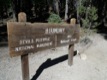
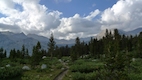
La John Muir Trail (JMT) est a hike stretching on 340 km, from Yosemite park to the Witney Mont - 4420m (Sierra Nevada digest point).
I used 14 days to hike including 4 days off to have a reste (and a shower) and refill my food.
Informations :
SF->Curry Village : Bus + train (via Merced) + Amtrack bus
Exit at Reds Meadows : shuttle at Reds Meadows Resort (eau hours) until Mammouth Village (actually I took 3 bus)
Exit via Kearsarge pass to Independence : walk down to Onion valley, hitchhiking to Independence
Wittney Portal -> Lone Pine : hitchhiking
Lone Pine -> SF : Bus (ou hitchhiking) until Lone Pine and then Mamouth, and bus to Curry Village, and so, back to SF.
... Aug 2010
Camera: Leica DLux 4
78 photos

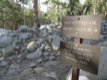
First step: ask the permit and the bear box at the Wilderness Center.

Bear box and contents

Hi !

No car here.

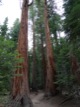
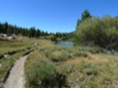
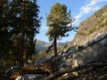
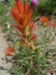
Cascade Nevada


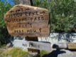
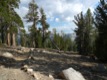
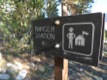
Sign for the trails

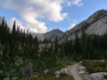
First night. One night before Surise Camp


Cathedral lake

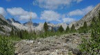
JMT and PCT share some part of trail


Thousand island lake


Reds Meadows


Purple lake


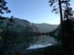
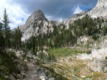
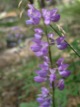
Virginia lac

Night at Tully hole (bad idea; there was so many mosquitoes and the ground was a big flat stone)


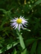
Lac Marie

Luxurious night

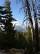
Cold morning

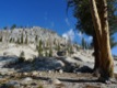
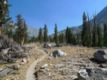
Easy to find the trail

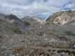
Wanda lake

Muir Pass

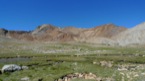
View to south from Muir Pass


Mind your step

Hi !


Water refill in the river


Mather pass

View from Mather pass (to nord, where I come from)

View from Mather pass (to south, where I go from)


Ice in my bag, brrrrr


Quiet deer

Cabane du ranger de Rae lake

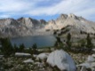
Rae lake

Bivouac prčs du Rea lake et Painted woman en toile de fond.

Petite déviation pour regagner la vallée voisine (Onion) pour acheter des vivres.

Descente vers Onion vallée oů je vais retrouver gite, couvert et douche !

Indépendence Village

Cowboy :-)

Boite ŕ ours, prčs des zones de camping fréquentées.

Bivouac prčs de "Center Bassin Trail"

Descente depuis le Forest pass, direction sud.


Timberline lake et chaine du mont Wittney en fond

Couché de soleil sur le mont Wittney

Bivouac ŕ l'abri du vent et lac guitare (3600m)

5h45, aprčs deux heures et demi de marche, le sommet approche (plus que 45 min).

Levé de soleil sur la Sierra Névada (partie entre mont Wittney en océan Pacifique)

Levé de soleil sur la chaine du Mont Wittney (avec le mont Muir sur la droite)

Summit ! 4420 m. Fin de la JMT.

Vue depuis le Mont Witney.

Vue depuis le Mont Witney.

Vue depuis le Mont Witney.

To Witney Portal

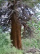
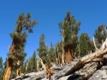
Huge !
Australia | Austria | Belgium | Bolivia | China | Denmark | Spain | France |Germany | Greece |
Hungary |
India |
Italy |
Montenegro |
Nepal |
Poland |
Norway |
Netherlands |
New Zealand |
Portugal |
Czechia |
Romania |
Russia |
Singapore |
Serbia |
Slovakia |
Slovenia |
Switzerland |
Thailand |
UK |
Ukraine |
USA |
Vatican city |
Vietnam
2001 -2022 Remi PRADELLE